Waterfalls in Árneshreppur
Hvalá and Rjúkandi
The mountain area west of Ófeigsfjörður has been the source of much controversy over proposed plans to build a hydropower plant utilizing the waters of the rivers Hvalá and Rjúkandi. These plans are on hold for now. This is a remote and barren area that is excellent for hiking, and also sports some good waterfalls:
Hvalárfoss is close to the sea, where the road ends.
The most impressive waterfall in Hvalá is Drynjandi, about 80m high. Quite spectacular.
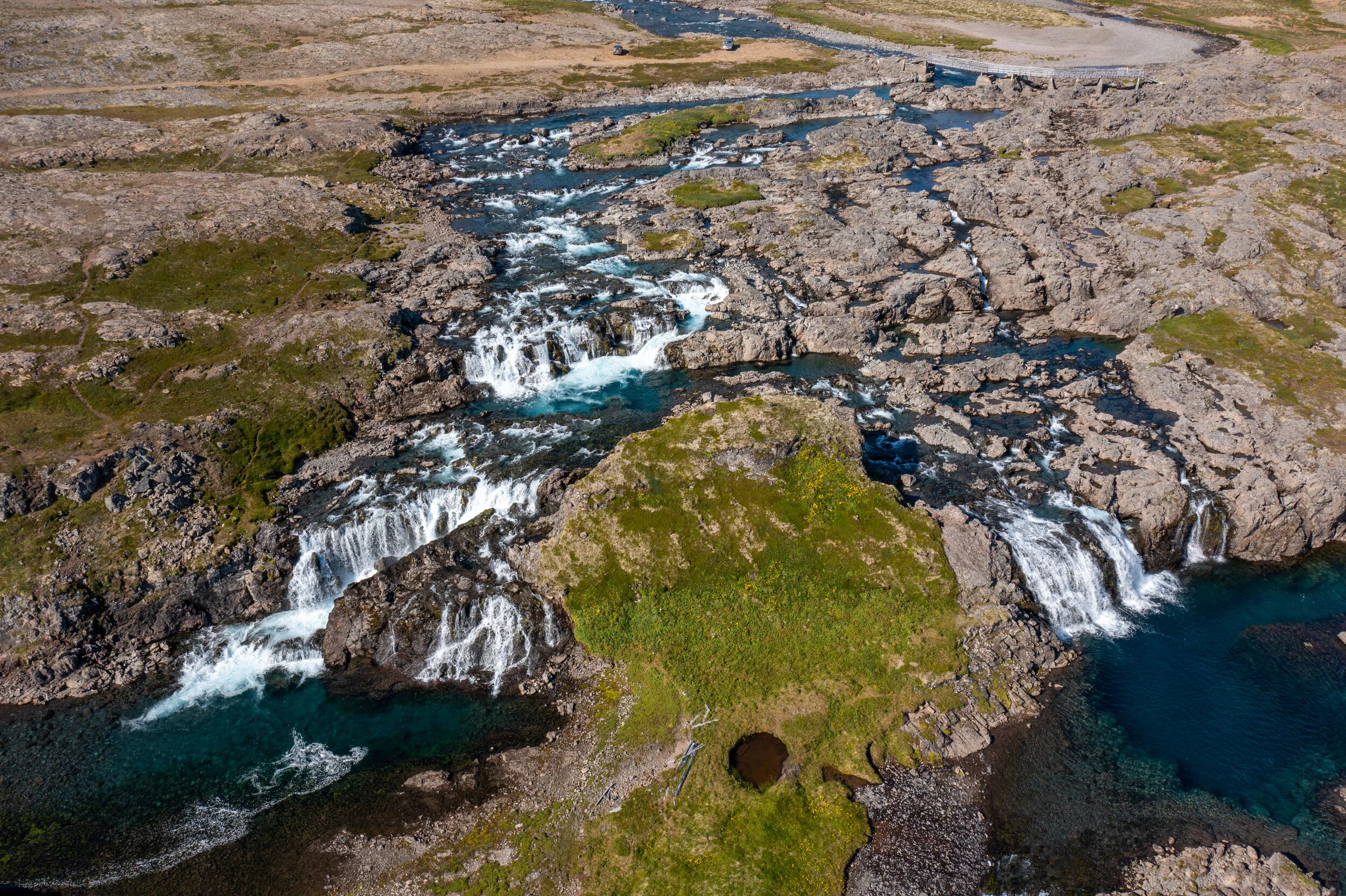
1km or so further upstream there are two small waterfalls here and here.
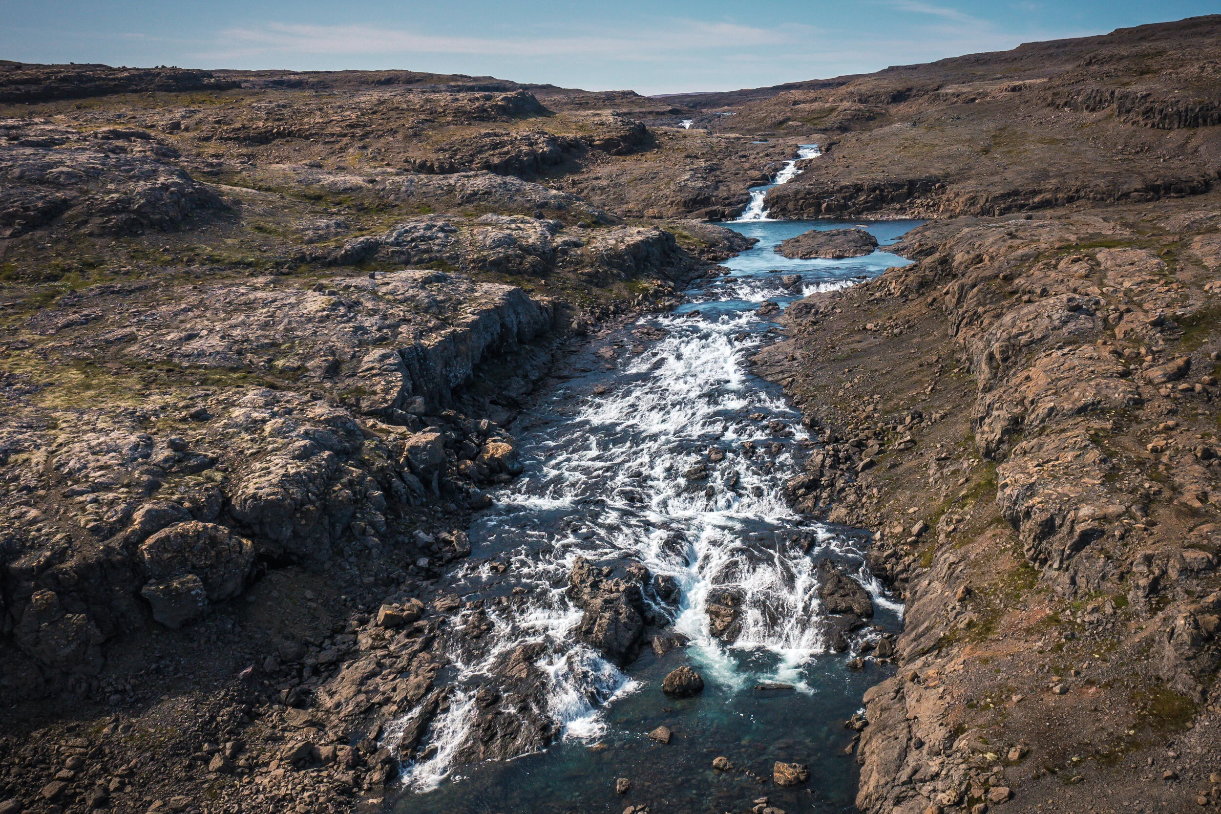
The river Rjúkandi is a tributary of Hvalá, flowing into it from the south. It has a sizeable waterfall called Rjúkandifoss and a smaller one just downstream.
Hiking to these waterfalls is a sizeable undertaking, over 20km in all. Although the hike is fairly easy, there are a few things to keep in mind:
Hvalá can only be crossed on a footbridge near the estuary.
There are almost no discernible trails and no mobile network.
Húsá can easily be crossed at low tide but at high tide a good 4x4 is required.
Fog is common.
The photos below were taken in mid-August when there was not a lot of water in the river. In June/July, when the snow is melting in the mountains, the rivers will be many times the size.
Hvalárfoss in Hvalá

Drynjandi in Hvalá

Waterfall in Hvalá
Waterfall in Hvalá

Rjúkandifoss in Rjúkandi

Waterfall in Rjúkandi
Húsá
The river Húsá flows into the southern part of Ófeigsfjörður. This is the last semi-inhabited place in “Strandir”. There is a small waterfall close to the sea and a much bigger one, Húsárfoss, a bit upstream. It’s large and in an open setting, so it was used as a navigation aid in times past.

Húsárfoss in Húsá

Waterfall in Húsá
Djúpavíkurá
Right above the mini-village of Djúpavík a waterfall comes straight off the mountain. It has the poetic name of Eiðrofi, which translates to “oath breaker”. It’s also referred to as Djúpavíkurfoss, which is a much less imaginative name.
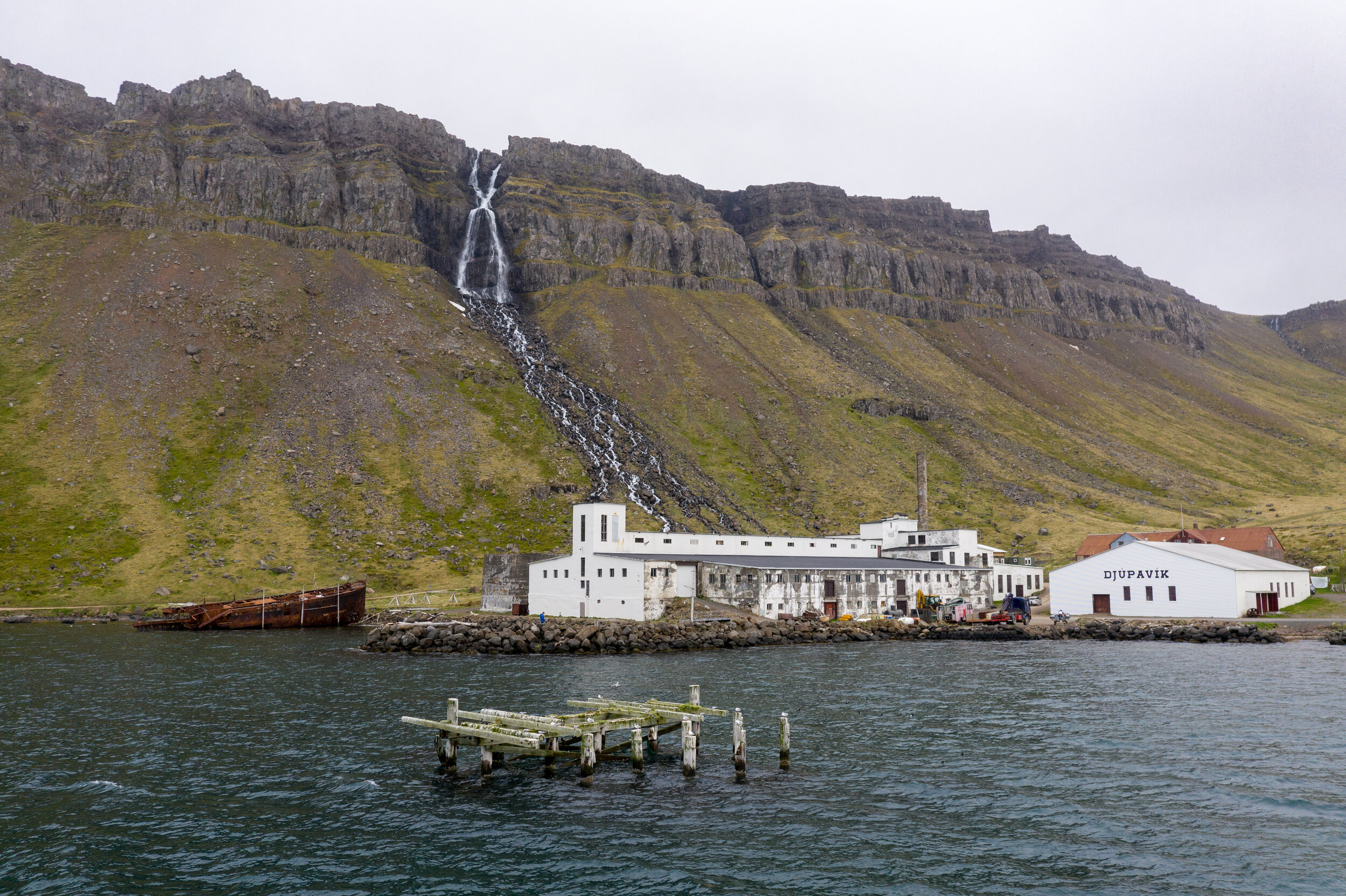
Eiðrofi in Djúpuvíkurá