Blog
A blog about photography and travel.

Weekend in Copenhagen
An autumn weekend in Copenhagen
I attended a three-day management meeting in Copenhagen from Monday to Wednesday, so I took the opportunity to travel out on Friday and spend the weekend in one of my favorite cities. Just walking around with the camera, dropping in on interesting restaurants and bars, and not thinking about much. There was not a lot of good light, so I focused on photographing the autumn colors, and visited the Botanical Gardens, which are always good for a few shots. I also took the train to Malmö, on the other side of the water.
The photographs are take, on a Fujifilm XE4, with various lenses, and a GFX50R with the 80mm f1.7 lens.


Snæfellsnes
Me and my brother go to Snæfellsnes on a whim.
My brother (and fellow photographer) Stefán called me on a Friday and suggested a trip to Snæfellsnes that same evening. Apparently his wife was having a small dinner party for her female friends and his presence in the house was “not required”. We drove to the village of Stykkishólmur and checked into the Foss Hotel where we had an excellent Christmas dinner. Hot tip: the restaurant at Foss Hotel is worth taking a trip for - highly recommended. Also, we packed some craft beers from Borg and a bottle of Nikka whisky so we were already winning before we started.
On Saturday morning we made our way along the north coast of the peninsula to Öndverðarnes before driving back to Reykjavík. At this latitude the sun is only up for 4-5 hours in mid December, rising to 3° above to horizon, so the time you have for daylight photography is limited.
The landscape bore the marks of recent snows and frosts except for the tip of the peninsula which, sticking out into the warmer sea, never really gets cold. Pretty flat light but, as often in Iceland, the clouds saved the day.

The mountain Gjafi is located at the bottom of Hraunsfjörður which is a fjord that Berserkjahraun lava field has almost closed off from the sea. On a calm day the mountains reflect beautifully in the water.
GFX50R + GF32-64 @ 64°56'41.8"N 23°00'54.5"W

Krákuhyrna (Crow’s horn) is just west of Gjafi. Still half an hour to sunrise but there was a little bit of color in the sky.
GFX50R + GF32-64 @ 64°56'41.8"N 23°00'54.5"W
Kirkjufell reflected in Lárvaðall lagoon, which was thawing up after a recent frost.
GFX50R + GF32-64 @ 64°56'25.1"N 23°22'36.7"W

The area on the northwest tip of Snæfellsnes is called Svörtuloft (black skies). It’s a desolate place of lava fields and cliffs where only seabirds live.
GFX50R + GF32-64 @ 64°51'50.2"N 24°02'22.8"W

Cliffs at Svörtuloft.
GFX50R + GF32-64 @ 64°51'50.2"N 24°02'22.8"W

Skarðsvík beach is a beautiful spot with golden sands under the black volcanic rocks. Best time for photography is at mid-tide.
GFX50R + GF32-64 @ 64°52'53.1"N 23°59'10.5"W

Skarðsvík beach.
GFX50R + GF32-64 @ 64°52'53.1"N 23°59'10.5"W

Cliffs east of Skarðsvík beach.
GFX50R + GF32-64 @ 64°53'00.3"N 23°58'53.9"W

Iceland south coast
Winter trip to the tourist-free south coast of Iceland.
During a dinner conversation, which inevitably ended up being a moaning session about the lack of travel opportunities due to Covid-19, it was somewhat optimistically decided take a short weekend break in Iceland. It turned out to be difficult to find a place to stay but we eventually settled on Hotel Katla just outside the small town of Vík on the Icelandic south coast, where we stayed for three nights. When the time came the weather forecast was so bad we almost cancelled but we decided to give it a go, which was fortunate as we had a great trip. We got upgraded to suites and had a couple of really nice dinners so were very happy with the hotel. Vík also sports the microbrewery Smiðjan which is a must-visit.
The south coast of Iceland from Eyjafjallajökull all the way to the east fjords is, in my opinion, the most beautiful part of Iceland that is easily accessible. Normally there are hordes of tourists even in winter but due to Covid-19 we almost had the place to ourselves. On Friday the weather cleared up towards the east so we drove all the way to Lómagnúpur and on Saturday we explored the area west of Vík. On Sunday we drove back to Reykjavík in glorious sunshine after having had to double back to the hotel due to a forgetting-camera-equipment-at-the-hotel incident: I had lined up a completely tourist-free shot of Skógafoss when I realized that the GFX was without its battery.

Kerlingardalur valley and Kerlingardalsá river in the evening light. “Kerling” is a not-so-young woman, nowadays used in derogatory sense.
GFX50R + GF32-65 @ 63°26'35.4" N 18°54'19.4" W

This massive rock stands in the sand about 600m south of Hjörleifshöfði. It’s called Arnardrangur or “Eagle’s rock”. There’s a another one just to the right called Lásadrangur. They must be fragments of Hjörleifshöfði. Maybe they got there in one of the massive floods that come from the glacier when Katla erupts?
GFX50R + GF100-200 @ 63°24'43.6" N 18°45'30.9" W
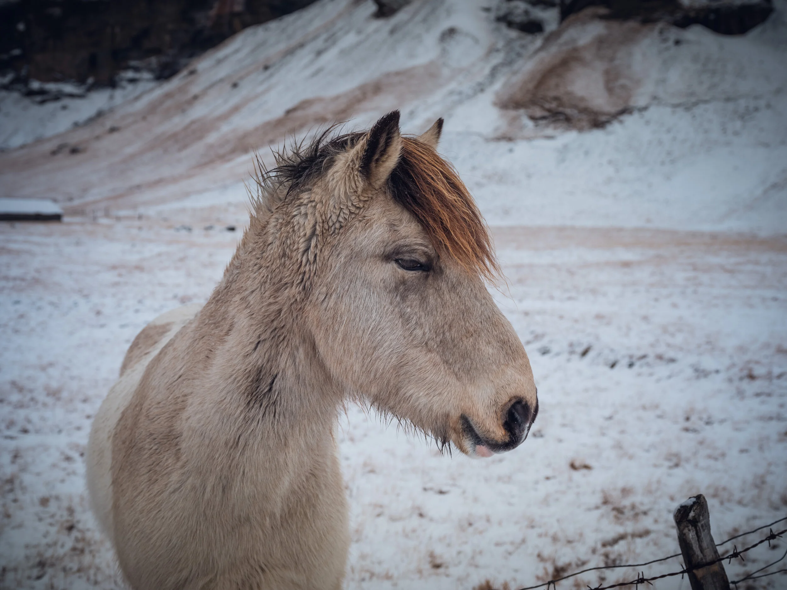
We met this handsome fellow near the farm of Núpur.
GFX50R + GF32-64 @ 63°56'53" N 17°38'6.4" W

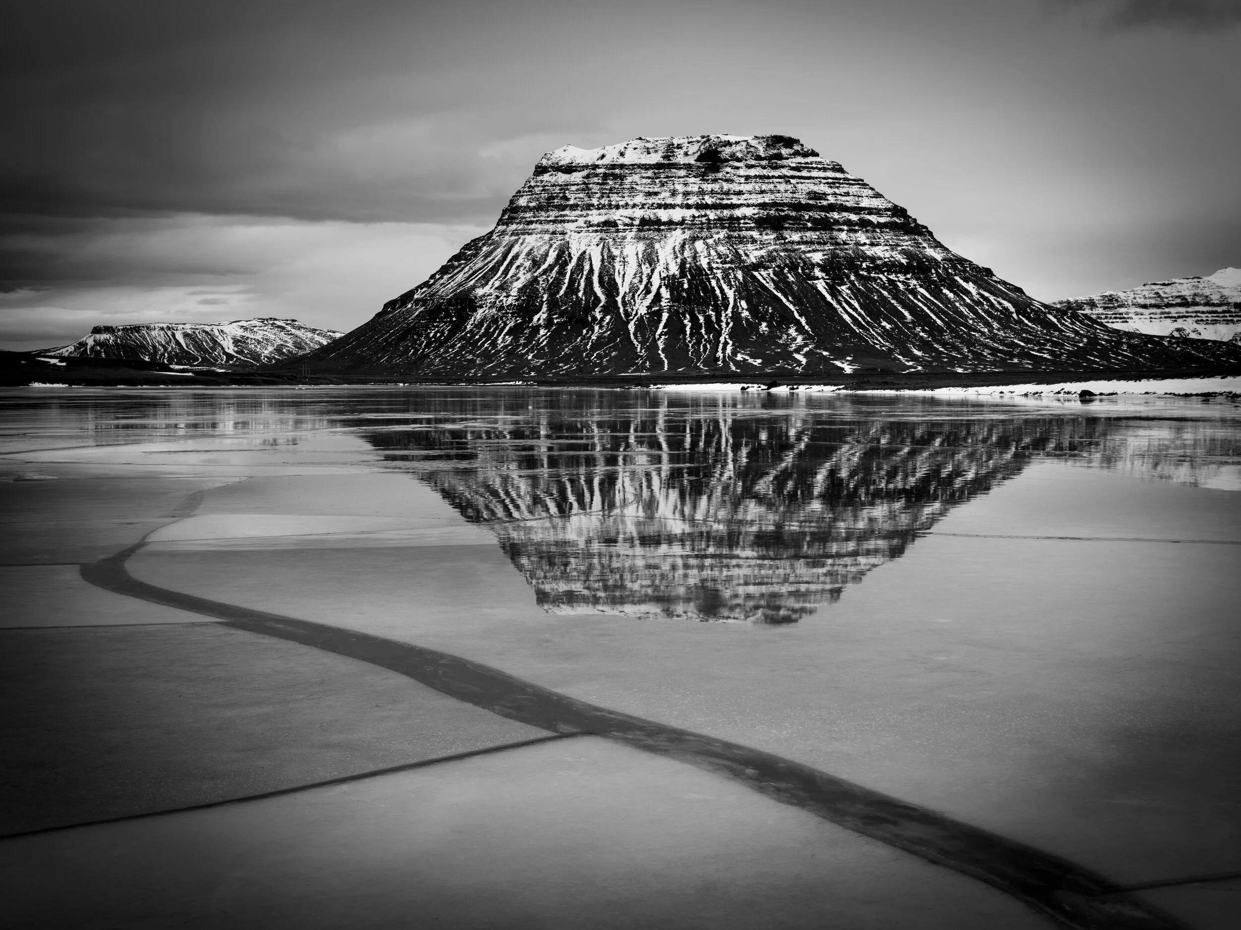
Lómagnúpur is one of the most picturesque mountains in Iceland, jutting out into a flat area from which it rises almost vertically. We saw it for the briefest of moments when the clouds parted.
GFX50R + GF32-64 @ 63°57'28.7" N 17°35'21.7" W

Reynisfjara beach is a favorite location of mine. I have never before been there alone, usually there are hundreds of people there, so this morning was a special treat. Untouched black sands, spectacular sunrise, the special sound of the surf as it moves the sand around, seabirds everywhere, solitude - nothing like it.
Fun fact 1: Next place directly south from Reynisfjara is the Antartic.
(Not so) Fun fact 2: The beach is extremely (and deceptively) dangerous as rogue waves can grab people and pull them out to sea. Stay well away from the sea and don’t get caught between it and the cliffs!
GFX50R + GF32-64 @ 63°24'11.5"N 19°02'44.9"W

Reynisfjara beach seen from Dyrhólaey.
GFX50R + GF32-64 @ 63°24'13.2" N 19°6'12.1" W

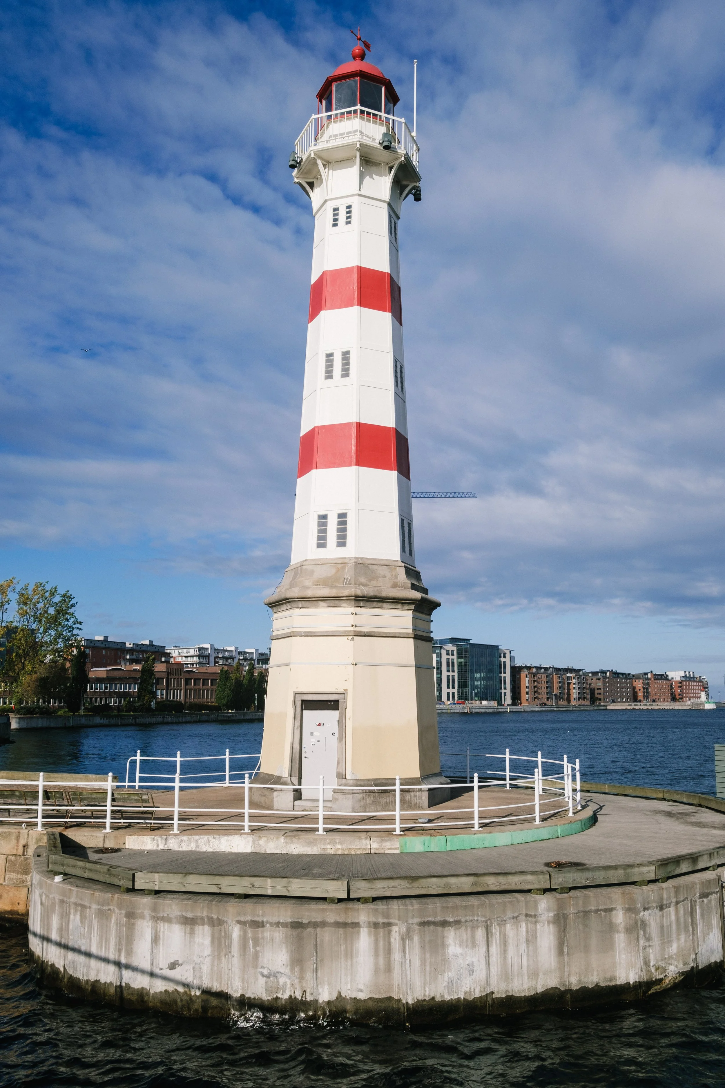
The views from Dyrhólaey are fantastic but as we almost got blown away by the hurricane-level winds we didn’t risk getting close to any promontories. So all I have is a picture of the lighthouse! Dyrhólaey is most famous for (and is named after) the huge stone arch on the sea side - through which an airplane has been flown.
GFX50R + GF32-64 @ 63°24'9" N 19°7'49.3" W


Having a beer in Covid-19 times with Bjargmundur and Guðný at Smiðjan Brugghús in Vík.
XT2 + XF16 @ 63°25'01.8"N 19°00'40.4"W

Drangshlíðarfjall mountain on our way back to Reykjavík. The famous Skógafoss waterfall is a few hundred meters to the right.
GFX50R + GF100-200 @ 63°30'57.5" N 19°27'46.4" W