Snæfellsnes
My brother (and fellow photographer) Stefán called me on a Friday and suggested a trip to Snæfellsnes that same evening. Apparently his wife was having a small dinner party for her female friends and his presence in the house was “not required”. We drove to the village of Stykkishólmur and checked into the Foss Hotel where we had an excellent Christmas dinner. Hot tip: the restaurant at Foss Hotel is worth taking a trip for - highly recommended. Also, we packed some craft beers from Borg and a bottle of Nikka whisky so we were already winning before we started.
On Saturday morning we made our way along the north coast of the peninsula to Öndverðarnes before driving back to Reykjavík. At this latitude the sun is only up for 4-5 hours in mid December, rising to 3° above to horizon, so the time you have for daylight photography is limited.
The landscape bore the marks of recent snows and frosts except for the tip of the peninsula which, sticking out into the warmer sea, never really gets cold. Pretty flat light but, as often in Iceland, the clouds saved the day.

The mountain Gjafi is located at the bottom of Hraunsfjörður which is a fjord that Berserkjahraun lava field has almost closed off from the sea. On a calm day the mountains reflect beautifully in the water.
GFX50R + GF32-64 @ 64°56'41.8"N 23°00'54.5"W

Krákuhyrna (Crow’s horn) is just west of Gjafi. Still half an hour to sunrise but there was a little bit of color in the sky.
GFX50R + GF32-64 @ 64°56'41.8"N 23°00'54.5"W
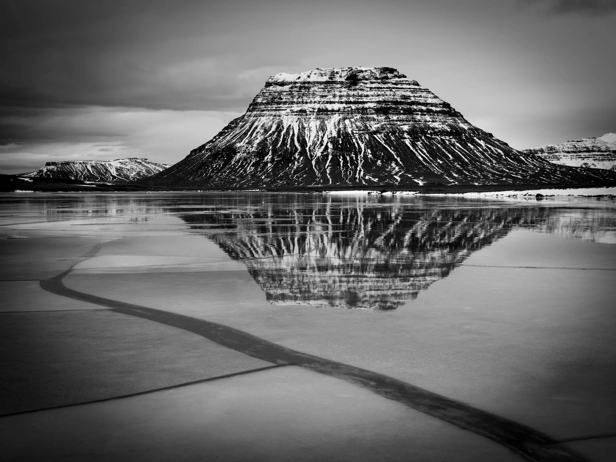
Kirkjufell reflected in Lárvaðall lagoon, which was thawing up after a recent frost.
GFX50R + GF32-64 @ 64°56'25.1"N 23°22'36.7"W

The area on the northwest tip of Snæfellsnes is called Svörtuloft (black skies). It’s a desolate place of lava fields and cliffs where only seabirds live.
GFX50R + GF32-64 @ 64°51'50.2"N 24°02'22.8"W

Cliffs at Svörtuloft.
GFX50R + GF32-64 @ 64°51'50.2"N 24°02'22.8"W

Skarðsvík beach is a beautiful spot with golden sands under the black volcanic rocks. Best time for photography is at mid-tide.
GFX50R + GF32-64 @ 64°52'53.1"N 23°59'10.5"W

Skarðsvík beach.
GFX50R + GF32-64 @ 64°52'53.1"N 23°59'10.5"W

Cliffs east of Skarðsvík beach.
GFX50R + GF32-64 @ 64°53'00.3"N 23°58'53.9"W