Trip to Akureyri
In the middle of July I travelled to Akureyri where I rented a holiday cottage. This has been a yearly trip for some time now where various family members come and go and we spend a week relaxing and exploring the area.
Akureyri is the biggest town in Iceland outside the capital area. It’s situated at the bottom of Eyjafjörður which also hosts a number of other villages that, together with Akureyri, create a vibrant cultural and economic community in the northern part of Iceland. It’s a perfect location for day trips to many of Iceland’s finest tourist attractions such as Mývatn, Námaskarð, Dettifoss, Ásbyrgi, Goðafoss, Húsavík and Siglufjörður. And for the more adventurous travelers there are mountains and remote areas to explore on foot or by car.
My first excursion was to Hvalvatnsfjörður. This is a now uninhabited valley which can be reached by track F839, for which you need a proper 4x4 that can cross rivers and handle the really bad track.
It was a nice day for photography with good light and clouds, but very windy. For next time I think a hike west to Þorgeirsfjörður would be interesting. It’ about 4km each way and there’s a bridge over the river, so it’s quite easy.


Next I took a short trip to the bottom of the valley south of Akureyri (Eyjafjarðardalur), which is an area I’ve never been to before. There’s a lot of farms but when you get off the beaten track there are deep valleys with high mountains and glimpses of glaciers and areas to explore on foot. In particular I think Djúpidalur looked like an interesting place to have a closer look at.
It was an overcast day but with nice clouds and the sun broke through once in a while.


On Sunday I took my parents to Flateyjardalur, which is the next valley east of Hvalvatnsfjörður, also uninhabited now. You get there by track F899 for which you need a 4x4 vehicle, particularly for the many river crossings. I managed to cut a tire when crossing a difficult river so me and my father had an interesting time figuring out how to get the spare tire from underneath a Toyota Land Cruiser. Nice job on the user manual Toyota, we managed it!
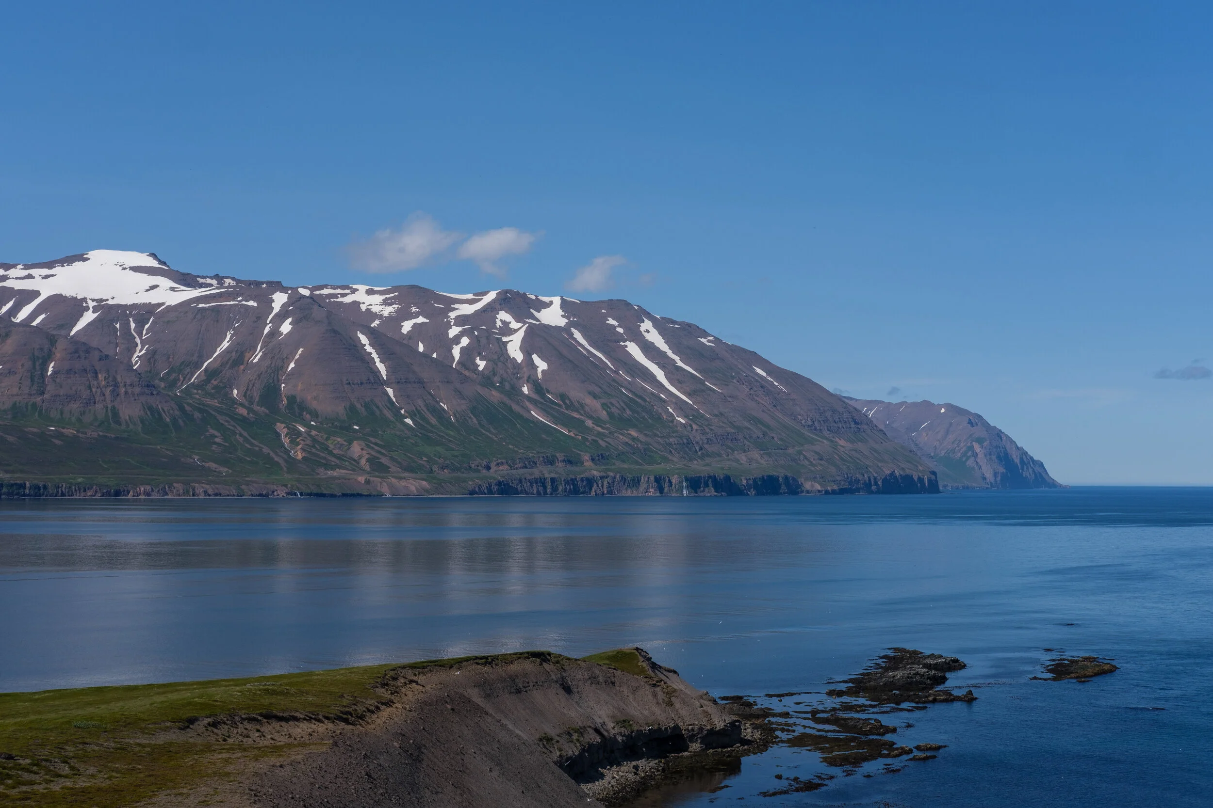
The track takes you to the sea and then you can drive across the shore line and up on Víkurhöfði, from where there are spectacular views of the area. To the north there is the island of Flatey, the last inhabited place in the area, after which the valley is named.
It was a sunny, mostly cloudless day so conditions for photography were not great. On the plus side I a saw a rock slide for the first time in my life and managed to take a photo of it.


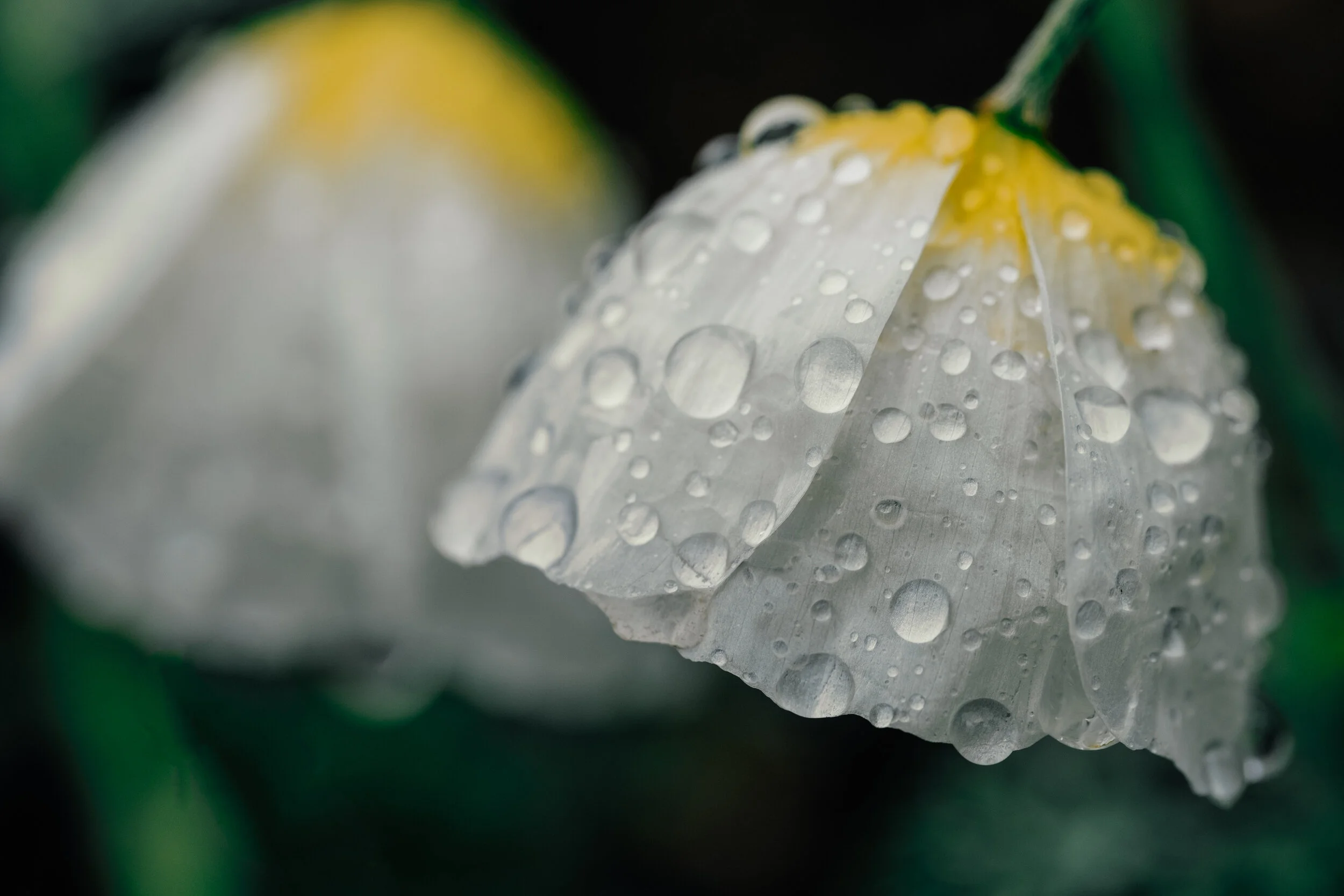
Akureyri itself is worth exploring for a day. My favorites are the old town, the botanical gardens, the town center and the industrial area in Oddeyri. The botanical gardens are the finest in Iceland and, if you like using your macro lens to photograph flowers (as I do), you can easily spend a few hours there. And when you need sustenance there’s a nice bistro as well.


The Final trip was to Hrísey, a small island in the middle of Eyjafjörður. It was the warmest day I can remember in Iceland (27C°!) and clear blue skies, so not so nice for photography. I walked from the harbor all the way to the northern tip of the island from where there are views to the open sea.
If you want to enjoy nature in solitude Hrísey is highly recommended. You can walk to the northern tip as I did, but there is also a spot much closer to the harbor (65°59'36.0"N 18°21'20.0"W) where you can enjoy the view to Látraströnd and feel completely alone in the world. Truly a magical place.
Note: If you do go to the northern tip you need to call the landowners and ask for permission. There’s a telephone number on a sign by the road. The lady that answered was very friendly and just wants to get notified that there are people on the land.